What is reverse geocoding?
Reverse geocoding is the process of converting GPS coordinates into a readable address, street or place. For example, "51.499403,-0.127362" becomes "Westminster Abbey, London, SW1P 3PA, United Kingdom".
Using the Swiftcomplete Reverse Geocoding API, you can convert a latitude, longitude into an accurate postal address, or generate a list of the closest addresses or places to a GPS coordinate.
Integrate the API or npm package in minutes with the reverse geocoding documentation & code samples.
How it works
Swiftcomplete's reverse geocoder works by searching for the closest matches to your provided coordinates. This is either calculated by straight-line distance, or by checking whether the coordinates are situated within a polygon (e.g. a country).
Depending on your use-case, reverse geocoding can operate at different levels of resolution or accuracy:
Address level
Exact address
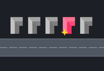
- Coordinates for each individual property
- Best possible data accuracy
- Returns nearest postal address to your coordinates
Address range
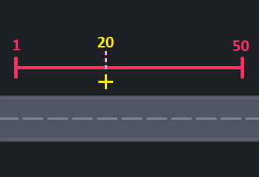
- Range of house numbers on a street
- Finds approximate house number
- Works best where houses are spaced evenly on the street
Street level
Street
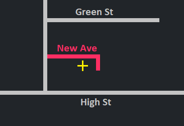
- Finds the closest street to your coordinates
- More accurate in countries where street polylines are available rather than centre-point coordinates
Place level
Place
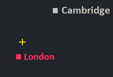
- Nearest city, town, village or suburb
- Measured by distance to the centre-point of the locality
Postcode
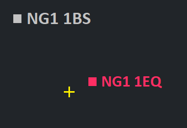
- Closest postal code or ZIP code
- Measured by distance to the centre-point of the postcode
Region level
Region
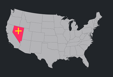
- Nearest state, county or admin area
- More accurate in countries where polygons are available rather than centre-point coordinates
Country
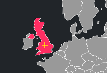
- Nearest country
- More accurate where polygons are available rather than centre-point coordinates
Data availability varies by region. Less granular datasets (such as region level or place level) are more cost effective, whereas high-resolution address level datasets provide the best possible accuracy.
If you need help choosing the best data for your project, contact us and we will be happy to help.
Get started
Make your first reverse geocoding request in under 2 minutes
Integrate Swiftcomplete Reverse Geocoding
Swiftcomplete's reverse geocoding is available through a simple API, or via a npm package:
@swiftcomplete/reverse-geocode
Installation
npm install @swiftcomplete/reverse-geocodeMaking a request
const swiftcompleteReverseGeocoder = require('@swiftcomplete/reverse-geocode');

swiftcompleteReverseGeocoder.setAPIKey('INSERT-KEY-HERE');

(async function () {
    let results = await swiftcompleteReverseGeocoder.reverseGeocode('51.499403,-0.127362', {});

    console.log(results);
}());
Response
[
    {
        "primary": {
            "text": "Westminster Abbey",
            "highlights": []
        },
        "secondary": {
            "text": "London",
            "highlights": []
        },
        "type": "address.residential.building.data.emptyroad",
        "isContainer": false,
        "geometry": {
            "centre": {
                "lat": 51.499462,
                "lon": -0.127448,
                "type": "address"
            }
        },
        "distance": {
            "units": "m",
            "measurement": 9,
            "type": "biasTowards",
            "geometry": {
                "centre": {
                    "lat": 51.499403,
                    "lon": -0.127362
                }
            }
        },
        "populatedRecord": {
            "lines": [
                "Westminster Abbey",
                "",
                "London",
                "SW1P 3PP",
                "United Kingdom"
            ],
            "label": "Westminster Abbey\nLondon\nSW1P 3PP\nUnited Kingdom"
        },
        "countryCode":"gb"
    }
]
Data coverage
At the moment, reverse geocoding is available in the following countries:
We regularly expand and improve our data coverage.
Do you have a requirement for a particular country or dataset? Get in touch and we'll let you know where it is on our priority list.
Reverse Geocoding Pricing
Our pay-as-you-go pricing is a quick and easy way to get started with reverse geocoding, and we also offer enterprise plans for high-volume usage. Pay-as-you-go credit packs are valid for 12 months, all prices exclude VAT.
If you have any questions about pricing, get in touch and we'll be happy to help.
£29
Get startedPrice per address
0.35p(£3.50 / 1000)
6p(£60 / 1000)
£50
Get startedPrice per address
0.35p(£3.50 / 1000)
5.8p(£58 / 1000)
£100
Get startedPrice per address
0.35p(£3.50 / 1000)
5.5p(£55 / 1000)
£225
Get startedPrice per address
0.3p(£3.00 / 1000)
5.2p(£52 / 1000)
£400
Get startedPrice per address
0.3p(£3.00 / 1000)
5p(£50 / 1000)
£900
Get startedPrice per address
0.3p(£3.00 / 1000)
4.8p(£48 / 1000)
Reverse Geocoding Enterprise plan
High volume and unlimited usage plans
Fixed price yearly contract
Priority customer support
Contact sales to get started with the Reverse Geocoding Enterprise Plan
